Entering a new harbor is always a bit hair-raising in a sailboat, with water depth a primary concern. Harbors like Fort Bragg that are at the mouth of a river, fight a continual battle with sediment to keep sufficient depth for boats to safely enter and berth. Sean is Adventure’s captain, course plotter, and linesman and I’m the helms-woman (I steer the boat), communications officer, and cook. It’s a system that works well for us and plays to our strengths. Having my brother aboard on passages to share some of these and other responsibilities makes our sailing safer and easier. He’s an experienced angler as well, so we are hoping to snag some fish along the way. Unfortunately, most sport fishing (rockfish, salmon, halibut, abalone) is closed just now to allow the populations to revive. But we can still try our luck 3 miles offshore if we’re feeling well enough.
I called the Noyo harbor master for a slip assignment and she told me that the harbor had been dredged in 2020 to 10’, so depth should not be a problem. As we come through the navigation markers, we were to look for the white light at the end of the channel. If it’s red or green, we are not lined up right and need to adjust. She said I should call the coast guard to ask about bar conditions. The coast guard told us bar conditions were good, but they were in a minus .5 tide, so the entrance may be too shallow for our 6-foot draft. I mentioned the recent dredging, but he was legally only able to give me depth data from a 2007 survey because there had not been an updated Army Corps of Engineers survey yet (I was told that the new survey report came in from them a few days after our arrival, so hopefully the navigation charts will get the new numbers soon).
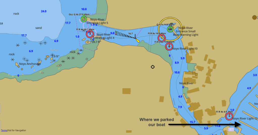
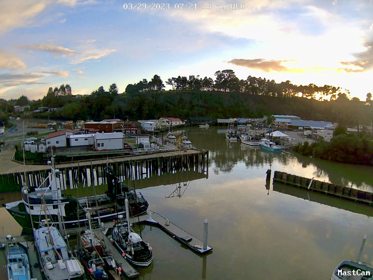
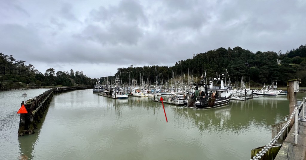
We crossed the bar with no issues (but this Coast Guard boat crossing the same bar in rough conditions is what we envisioned was about to take place). The 82-foot-wide channel is the second-narrowest on the West Coast. I was focused on the depths shown on my chart plotter and keeping Adventure in the deepest parts. Sean and Tim saw the white light, which meant we were on course. We passed the Noyo River harbor front where the fish and crab boats unload their catch on the back of the buildings and consumers buy the same on the front of the buildings. That’s about as fresh as you can get it!
This marina has shared slips, meaning that there is a dock only on one side of your boat. On the other side is another boat. I asked for a port-side tie-up because our propeller pushes us in that direction when we reverse. I want to push into the doc when I reverse to stop, rather than into the crab boat next to us. Sean doesn’t think it matters because he can jump off the boat and tie us up, but it makes me feel better and more in control. So, we are in Fort Bragg for a week or two, awaiting a two or three-day weather window to get to Crescent City or Brookings.
Author: Kathy; Feature photo is the Noyo harbor entrance, taken from Adventure’s Mastcam.
